On the Arvert Peninsula, north of the Royan urban area, several initiatives are being conducted in concert to adapt public access and infrastructure to the rapid evolution of the coastline. These efforts include the renaturation of the Embellie parking lot, preparation of sediment management operations, and a study on the future of the departmental road 25 (RD25) and the Vélodyssée, charting a common adaptation trajectory.
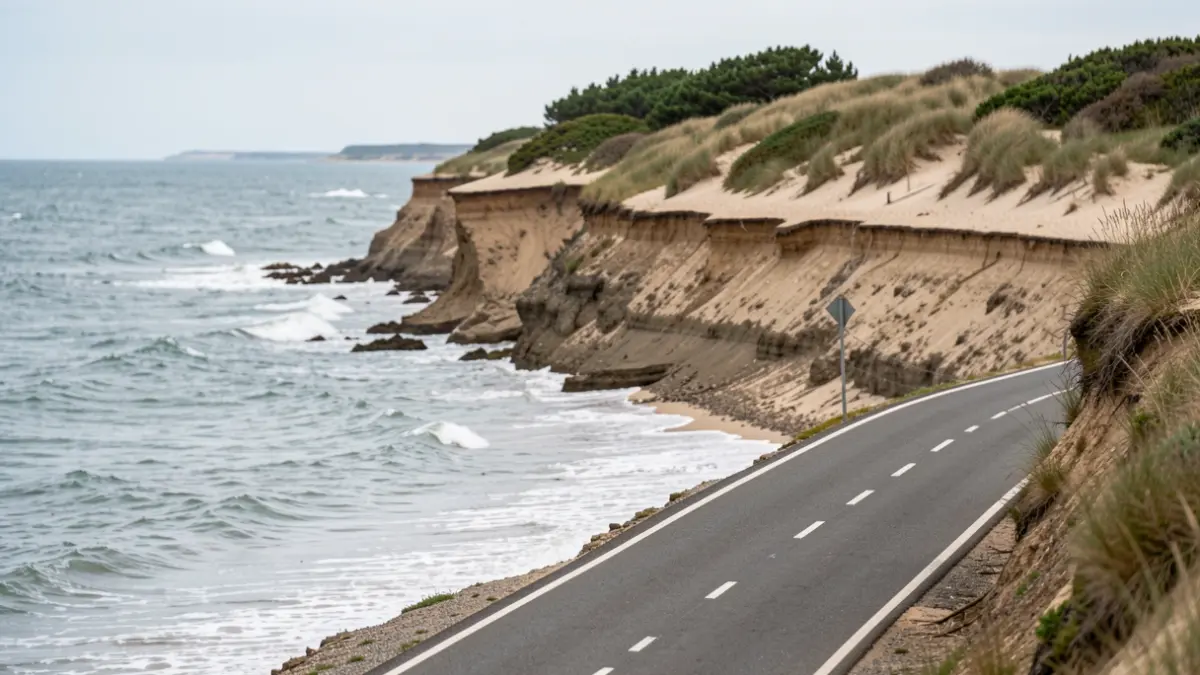
Coastal erosion on Embellie beach has already necessitated the repeated relocation of a section of the Vélodyssée, compromising site access and raising long-term questions about the durability of the RD25. Concerned local authorities and partners are therefore working at multiple levels: short-term intervention on the site, support for dune functioning, and preparation for mobility evolution across the entire peninsula.
A first phase of renaturation is planned for winter 2026. In October 2026, the steering committee for the recomposition of Embellie and Galon d'Or beaches reviewed a project evolution. The current direction is to anticipate the closure of the Embellie parking lot and the renaturation of the area, abandoning the idea of temporarily maintaining parking capacity.
This initial phase will involve removing the artificialized surfaces of the parking lot, as well as sections of roadway and cycle path that are no longer used and are exposed to erosion. A technical and emergency access will be maintained. Fencing, branches, and adapted signage will support vegetation recovery and channel pathways. Car parking will be entirely relocated to Galon d'Or.
In parallel, the Communauté d’Agglomération Royan Atlantique (CARA) is preparing a sediment management plan. The presented orientations include sand nourishment spread over several years to restore dune volume at Embellie and limit the exposure of infrastructure located behind the site.
CARA launched a feasibility study on June 2, 2026, for the relocation of the RD25 and the Vélodyssée on the Arvert Peninsula. Scheduled until the end of 2027, this study aims to go beyond ad-hoc responses after each erosion event and build a coherent strategy for the entire sector.
The study examines the functions of the road and cycle routes, such as beach access, tourist and daily travel, forestry operations, emergency access, and evacuation in case of major risk. It also considers natural environments, seasonal attendance, road network capacity, and land and regulatory constraints.
In September 2026, a field workshop brought together elected officials and concerned partners to share the diagnosis for the peninsula, discussing the uses of the RD25, exposed areas, and access continuity. These exchanges will inform the development of adaptation scenarios for the road and the Vélodyssée.
At the heart of the Arvert Peninsula, the Coubre massif has a committee that met on September 29 at CARA headquarters. Issues of fire safety, tourist reception, site accessibility, and user conflicts were addressed.
Fire risk was central to the discussions, and the president of CARA requested an assessment of fire risks in other sensitive areas, particularly the Combots and Suzac forests, to promptly implement necessary actions.
In the face of erosion risk, he also recalled the need to plan for diversion routes to secure flows and maintain accessibility to resorts and tourist sites. ONF presented work on tourist reception, and the committee was informed of the progress of the Cœur de Coubre project and the rehabilitation of the former school, with completion announced for the end of 2026.
The GIP Littoral is involved in the monitoring of Embellie and Galon d'Or recomposition and the study conducted on the peninsula, helping to link sustainable coastal territory development projects with adaptation strategies to coastal retreat.